Wind Speed Probabilities
Tim Trice
June 11, 2017
Source:vignettes/wind_speed_probabilities.Rmd
wind_speed_probabilities.Rmd
key <- "AL092008"
adv <- 42GIS Advisory Forecast Track, Cone of Uncertainty, and Watches/Warnings
gis_adv <- gis_advisory(key = key, advisory = adv) %>% gis_download()## Warning in OGRSpatialRef(dsn, layer, morphFromESRI = morphFromESRI, dumpSRS =
## dumpSRS, : Discarded ellps Sphere in Proj4 definition: +proj=longlat +R=6371200
## +no_defs## Warning in OGRSpatialRef(dsn, layer, morphFromESRI = morphFromESRI, dumpSRS
## = dumpSRS, : Discarded datum Not_specified_based_on_Authalic_Sphere in Proj4
## definition: +proj=longlat +R=6371200 +no_defs## Warning in showSRID(wkt2, "PROJ"): Discarded ellps Sphere in Proj4 definition:
## +proj=longlat +R=6371200 +no_defs +type=crs## Warning in showSRID(wkt2, "PROJ"): Discarded datum Not specified (based on
## Authalic Sphere) in Proj4 definition## OGR data source with driver: ESRI Shapefile
## Source: "/tmp/Rtmpgkrj8X", layer: "al092008.042_5day_lin"
## with 2 features
## It has 9 fields## Warning in OGRSpatialRef(dsn, layer, morphFromESRI = morphFromESRI, dumpSRS =
## dumpSRS, : Discarded ellps Sphere in Proj4 definition: +proj=longlat +R=6371200
## +no_defs## Warning in OGRSpatialRef(dsn, layer, morphFromESRI = morphFromESRI, dumpSRS
## = dumpSRS, : Discarded datum Not_specified_based_on_Authalic_Sphere in Proj4
## definition: +proj=longlat +R=6371200 +no_defs## Warning in showSRID(wkt2, "PROJ"): Discarded ellps Sphere in Proj4 definition:
## +proj=longlat +R=6371200 +no_defs +type=crs## Warning in showSRID(wkt2, "PROJ"): Discarded datum Not specified (based on
## Authalic Sphere) in Proj4 definition## OGR data source with driver: ESRI Shapefile
## Source: "/tmp/Rtmpgkrj8X", layer: "al092008.042_5day_pgn"
## with 2 features
## It has 9 fields## Warning in OGRSpatialRef(dsn, layer, morphFromESRI = morphFromESRI, dumpSRS =
## dumpSRS, : Discarded ellps Sphere in Proj4 definition: +proj=longlat +R=6371200
## +no_defs## Warning in OGRSpatialRef(dsn, layer, morphFromESRI = morphFromESRI, dumpSRS
## = dumpSRS, : Discarded datum Not_specified_based_on_Authalic_Sphere in Proj4
## definition: +proj=longlat +R=6371200 +no_defs## Warning in showSRID(wkt2, "PROJ"): Discarded ellps Sphere in Proj4 definition:
## +proj=longlat +R=6371200 +no_defs +type=crs## Warning in showSRID(wkt2, "PROJ"): Discarded datum Not specified (based on
## Authalic Sphere) in Proj4 definition## OGR data source with driver: ESRI Shapefile
## Source: "/tmp/Rtmpgkrj8X", layer: "al092008.042_5day_pts"
## with 13 features
## It has 20 fields## Warning in OGRSpatialRef(dsn, layer, morphFromESRI = morphFromESRI, dumpSRS =
## dumpSRS, : Discarded ellps Sphere in Proj4 definition: +proj=longlat +R=6371200
## +no_defs## Warning in OGRSpatialRef(dsn, layer, morphFromESRI = morphFromESRI, dumpSRS
## = dumpSRS, : Discarded datum Not_specified_based_on_Authalic_Sphere in Proj4
## definition: +proj=longlat +R=6371200 +no_defs## Warning in showSRID(wkt2, "PROJ"): Discarded ellps Sphere in Proj4 definition:
## +proj=longlat +R=6371200 +no_defs +type=crs## Warning in showSRID(wkt2, "PROJ"): Discarded datum Not specified (based on
## Authalic Sphere) in Proj4 definition## OGR data source with driver: ESRI Shapefile
## Source: "/tmp/Rtmpgkrj8X", layer: "al092008.042_ww_wwlin"
## with 5 features
## It has 10 fieldsGet bounding box of the forecast polygon.
bbox <- bbox(gis_adv$al092008.042_5day_pgn)
bbox
## min max
## x -98.10178 -80.20625
## y 25.25667 41.78703Build a Tracking Chart
Generate a base plot of the Atlantic ocean.
bp <- al_tracking_chart(color = "black", fill = "white", size = 0.1, res = 50)## Regions defined for each Polygons
## Regions defined for each Polygons## Coordinate system already present. Adding new coordinate system, which will replace the existing one.
bp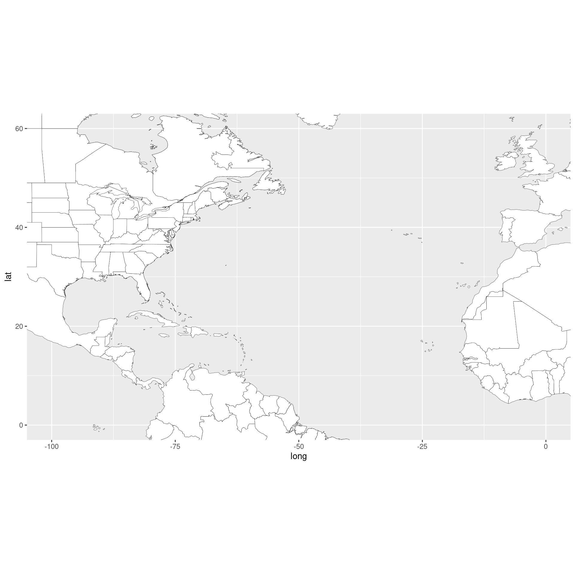
I like to add a little cushion for the map inset and forecast cone data.
lat_min <- bbox[2,1] - 5
lat_max <- bbox[2,2] + 5
lon_min <- bbox[1,1] - 10
lon_max <- bbox[1,2] + 10
Build a thin tracking map for the inset.
bp_inset <- ggplotGrob(bp +
                           geom_rect(mapping = aes(xmin = lon_min, xmax = lon_max,
                                                   ymin = lat_min, ymax = lat_max),
                                     color = "red", alpha = 0) +
                           theme_bw() +
                           theme(axis.title = element_blank(),
                                 axis.ticks = element_blank(),
                                 axis.text.x = element_blank(),
                                 axis.text.y = element_blank(),
                                 plot.margin = margin(0, 0, 0, 0, "pt")))
Modify original bp zoomed in on our area of interest.
bp <- bp +
    coord_equal(xlim = c(lon_min, lon_max),
                ylim = c(lat_min, lat_max)) +
    scale_x_continuous(expand = c(0, 0)) +
    scale_y_continuous(expand = c(0, 0)) +
    labs(x = "Lon",
         y = "Lat",
         caption = sprintf("rrricanes %s", packageVersion("rrricanes")))
## Coordinate system already present. Adding new coordinate system, which will replace the existing one.
bp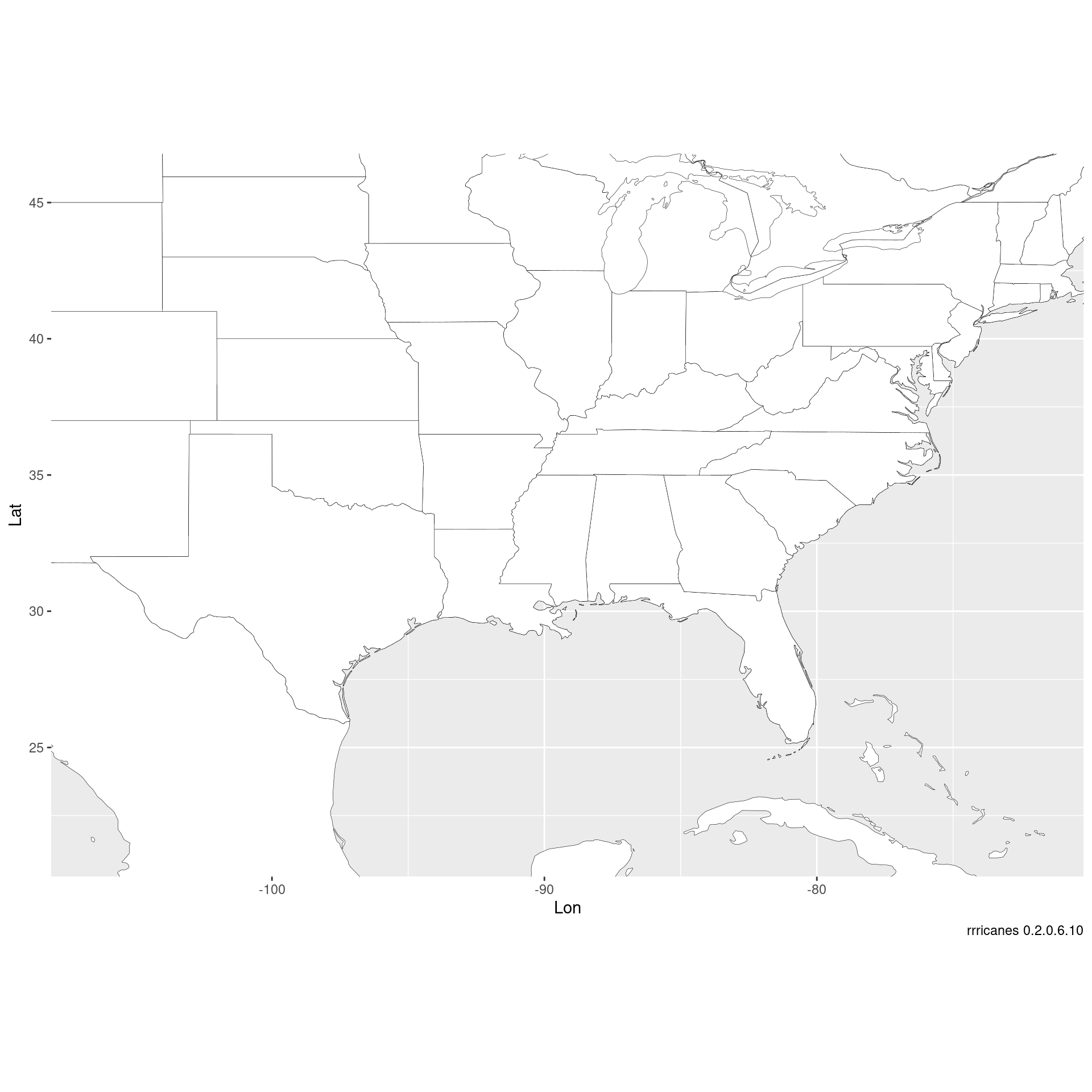
Combine bp and bp_inset to finalize initial base plot. bp will be a base plot without the inset. bpi will have the inset.
bpi <- bp + annotation_custom(grob = bp_inset, xmin = lon_max - 5,
                              xmax = lon_max - 1, ymin = -Inf,
                              ymax = lat_min + 5)
bpi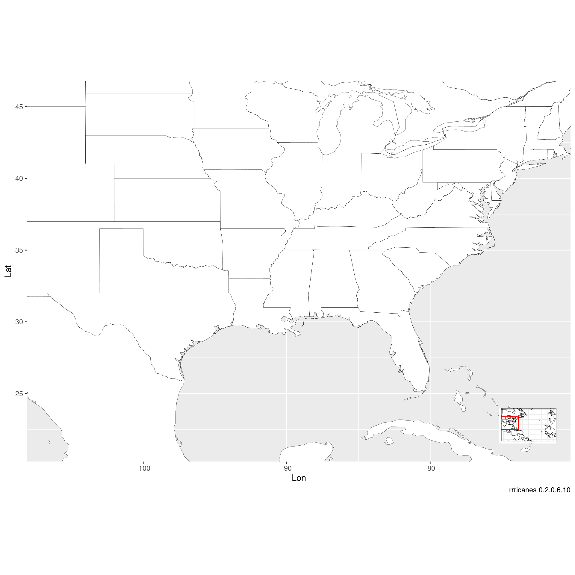
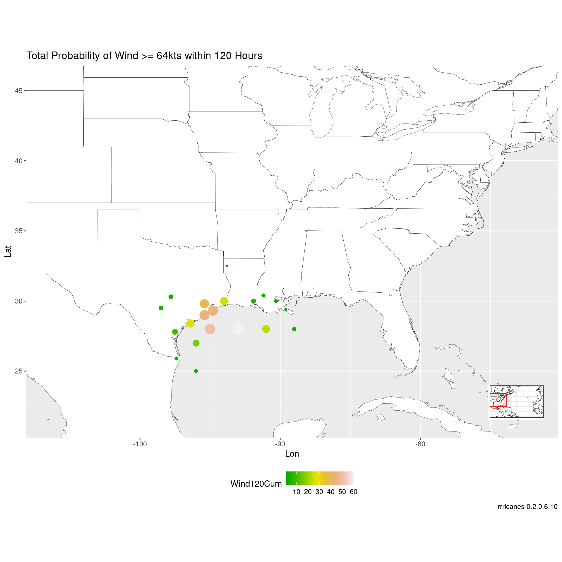
The wndprb will not have coordinates for cities. An option is al_prblty_stations. However, please note this function may become deprecated.
wndprb <-
    wndprb %>%
    left_join(al_prblty_stations(), by = "Location") %>%
    mutate_at(.vars = c("Lat", "Lon"), .funs = as.numeric)
## Warning: Expected 7 pieces. Additional pieces discarded in 1 rows [90].Check wndprb for NA values in Lat, Lon.
## [1] TRUE
wndprb_adv42 <- filter(wndprb, Adv == adv, Wind >= 64)

bpi +
    geom_point(
        data = wndprb_adv42,
        aes(
            x = Lon,
            y = Lat,
            color = Wind120Cum,
            size = Wind120Cum
        )
    ) +
    scale_color_gradientn(colors = terrain.colors(10)) +
    guides(size = FALSE) +
    theme(
        legend.position = "bottom",
        legend.box = "vertical"
    ) +
    labs(title = "Total Probability of Wind >= 64kts within 120 Hours")
## Warning: `guides(<scale> = FALSE)` is deprecated. Please use `guides(<scale> =
## "none")` instead.