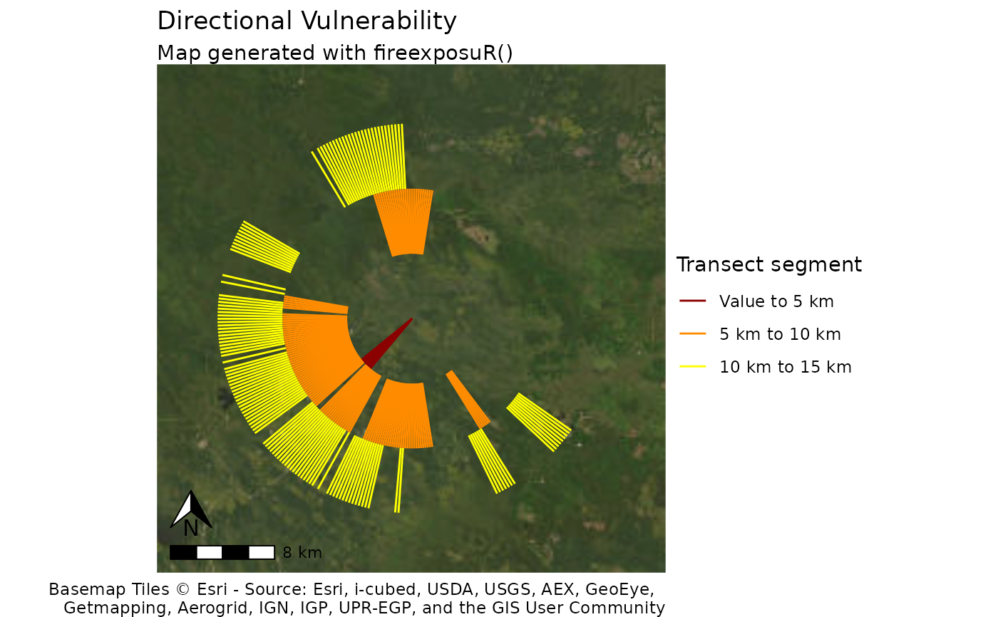
fire_exp_dir_map() plots directional exposure transects onto
a map.
Arguments
- transects
SpatVector. Output from
fire_exp_dir()- value
(Optional) SpatVector. Adds the value to the map. Use the same value feature used to generate the transects with
fire_exp_dir()- labels
(Optional) a vector of three strings. Custom formatting for the distances in the legend. If left blank, the function will automatically label the distances in meters.
- title
(Optional) String. A custom title for the plot. The default is
"Directional Vulnerability"
Details
This function returns a standardized map with basic cartographic elements.
The plot is returned as a tmap object which can be further customized using
tmap commands or exported/saved to multiple image file formats. See
tmap::tmap_save() for export details.
Spatial reference
This function dynamically pulls map tiles for a base map. The crs is set
automatically. See tmap::tm_crs() for details.
Examples
# \donttest{
# read example hazard data
hazard_file_path <- "extdata/hazard.tif"
hazard <- terra::rast(system.file(hazard_file_path, package = "fireexposuR"))

# generate an example point
point_wkt <- "POINT (345000 5876000)"
point <- terra::vect(point_wkt, crs = hazard)

# compute exposure metric
exposure <- fire_exp(hazard)

# generate transects
transects <- fire_exp_dir(exposure, point, interval = 5)

fire_exp_dir_map(transects)
#> [basemaps] Tiles from "Esri.WorldImagery" will be projected so details (e.g.
#> text) could appear blurry
#> This message is displayed once per session.

# }
# }