The Analyst is a set of optional features in OTP 1.x used for transport analysis. These features were removed from OTP 2.0. This vignette will explain how to enable and use these features.
Analyst Features
The Analyst adds the following features to OTP:
- PointSets - A more efficient way to specify a batch of fromPlace / toPlaces for routing.
- Surfaces - A efficient way to get travel time from one to many places.
- Isochrones - An alternative implementation of the Isochrone features.
Loading OTP with the Analyst
The analyst is an optional feature in OTP 1.x and can be loaded in
otp_setup.
# Get OTP and the Demo Data in the normal way
library(opentripplanner)
path_data <- file.path(tempdir(), "OTP")
dir.create(path_data)
path_otp <- otp_dl_jar(version = "1.5.0") #Must use OTP 1.x
otp_dl_demo(path_data)
log1 <- otp_build_graph(otp = path_otp, dir = path_data)

# Setup OTP with the analyst and pointsets enabled
log2 <- otp_setup(otp = path_otp, dir = path_data, analyst = TRUE, pointsets = TRUE)
otpcon <- otp_connect(timezone = "Europe/London")
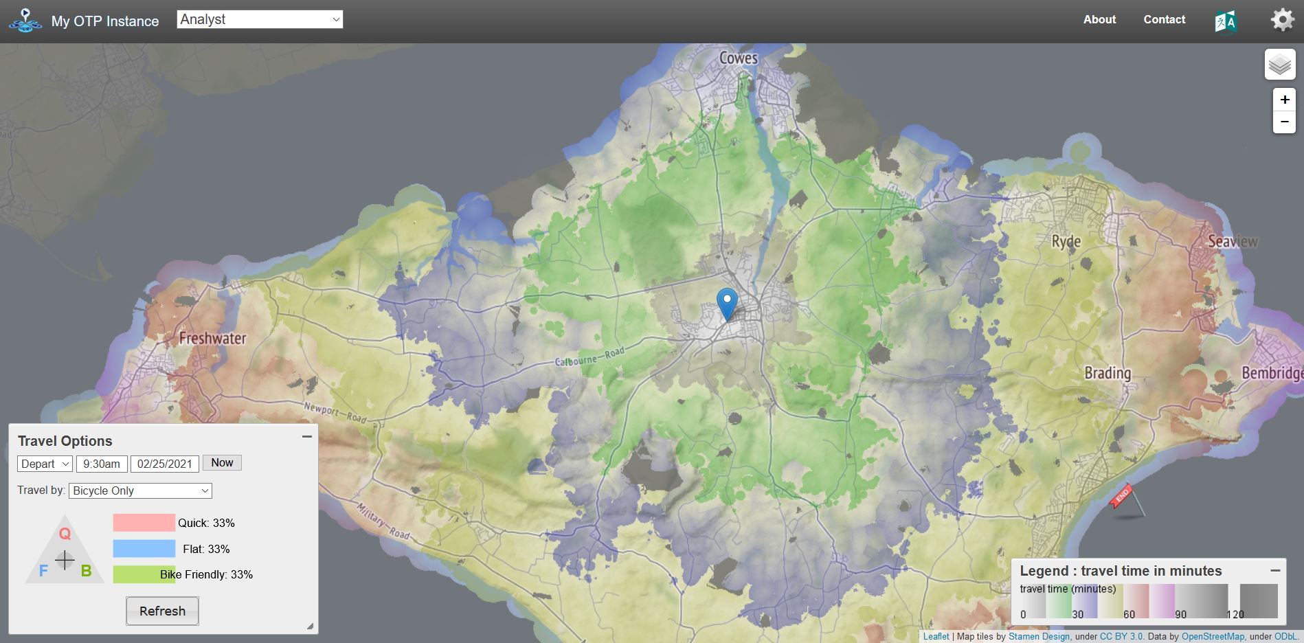
You can see the analyst is working in the web UI.

OTP Web Interface in Analyst Mode
Creating a Pointset
You will have noticed that when we started OTP we also enabled the
Pointsets feature. Pointsets are .csv files of
latitude/longitude coordinates that OTP can route to. PointSets can be
created from SF objects using the otp_poinset()
function.
We will use the LSOA points from the Advanced Features Vignette to create a PointSet. We will also add a column of data called jobs to analyse. For any numerical values in a PointSet OTP can provide the count and sum of that value based on travel criteria. In this case we might want to know how many jobs can be accessed within a 30 minute drive of a given location.
download.file("https://github.com/ropensci/opentripplanner/releases/download/0.1/centroids.gpkg",
              "centroids.gpkg", mode = "wb")
lsoa <- sf::st_read("centroids.gpkg", stringsAsFactors = FALSE)
lsoa$jobs <- sample(100:500, nrow(lsoa))
otp_pointset(lsoa, "lsoa", path_data)
Here the otp_pointset() function takes the
lsoa object and creates a PointSet that can be accessed by
OTP using the name “lsoa”.
Creating a Surface
A surface evaluates the travel times from a given point to all locations within 120 minutes in one minute increments. So it quite similar to an isochrone.
The fist step is to make a surface from a given location using
otp_make_surface
surfaceid <- otp_make_surface(otpcon, c(-1.17502, 50.64590))The otp_make_surface function returns a list containing
the surface ID and the parameters used to create the surface. You can
use this object in other functions that support surfaces.
Once the surface has been made we can evaluate the travel times to our pointset.
ttimes <- otp_surface(otpcon, surfaceid, "lsoa")The otp_surface function returns a list of two objects.
The first object data is a data frame summarising the sum
and count of any values in the pointset in one minute increments from
the fromPlace specified by the surfaceid
object. The second object times is a vector of travel times
in seconds to each of the locations in the pointset. NA values are
returned if OTP was unable to find a route to the point or if the point
is more than 120 minutes from the fromPlace.
If you are not using the sum and count features you can specify
get_data = FALSE to get just the travel times.
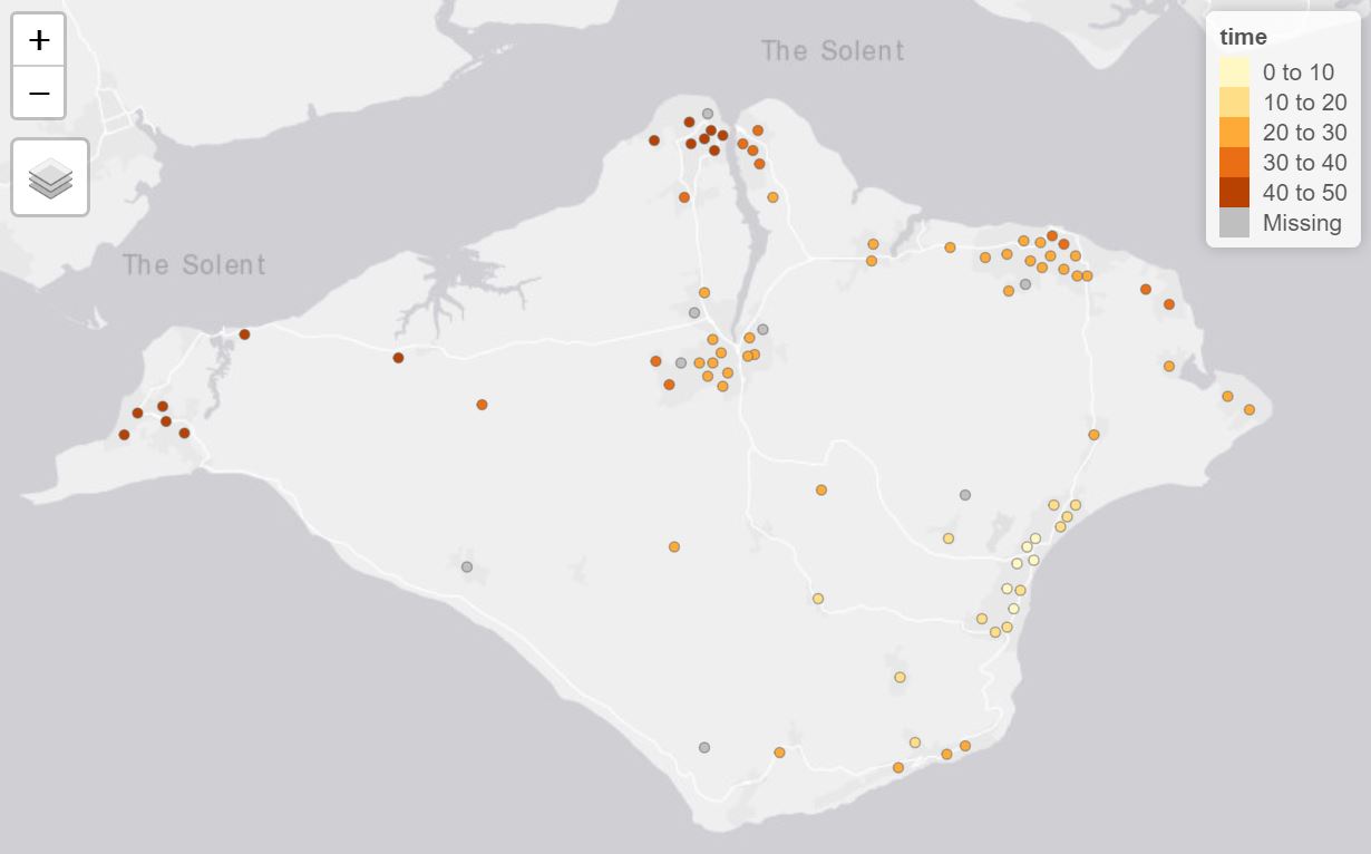
ttimes <- otp_surface(otpcon, surfaceid, "lsoa", get_data = FALSE)We can visualise the travel times using the tmap
package.
lsoa$time <- ttimes[[1]]$times / 60
library(tmap)
tmap_mode("view")
tm_shape(lsoa) +
  tm_dots(col = "time")
Travel times to LSOA points
Notice that there are a few locations where OTP has failed to find a
travel time. It is likely that point is too far from the road network to
route, or the mode does not allow access (e.g. driving up a
pedestrianised road). You could try modifying your point locations
slightly to allow OTP to find a valid route.
Producing a travel time matrix
We can use surfaces as a more efficient way to produce a travel time
matrix than using otp_plan. A special function
otp_traveltime creates batches of surfaces and pointsets
and summarises the results as a travel time matrix.
ttmatrix <- otp_traveltime(otpcon,
                           path_data,
                           fromPlace = lsoa,
                           toPlace = lsoa,
                           fromID = lsoa$geo_code,
                           toID = lsoa$geo_code)
The function will return the travel times in seconds between the
fromPlaces and toPlaces as a data frame. With columns names from
fromID and row names from toID. Any failed
routes will return and NA, as will any greater than 120 minutes.
Producing an isochrone from a surface
The surfaces can also be used to produce isochrones from a surface. Only one raster can be produced at a time. If you provide a list of surfaces only the first will be used.
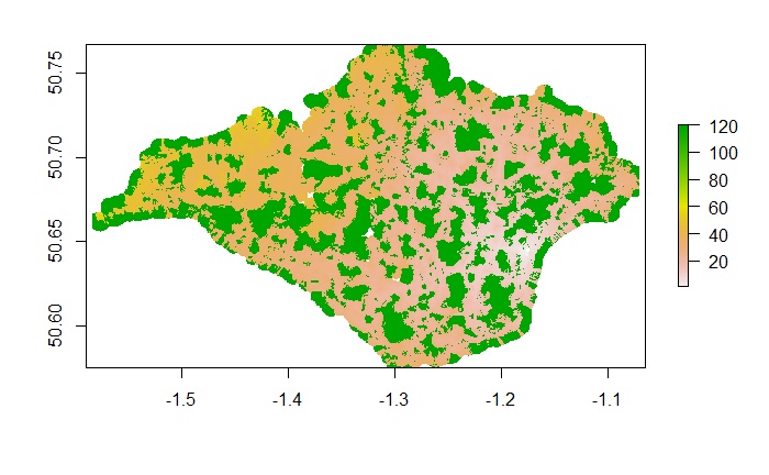
isochone <- otp_surface_isochrone(otpcon, surfaceid)The function otp_surface_isochrone returns a raster
image with the value of the travel time in minutes. You can view the
raster using the raster package.

Isochone Raster
