Obtain the information about of an eLTER activity.
Source:R/get_activity_info.R
get_activity_info.Rd![[Stable]](figures/lifecycle-stable.svg) This function obtains the information about of an eLTER
activity (e.g.
https://deims.org/activity/8786fc6d-5d70-495c-b901-42f480182845)
provided in DEIMS-SDR catalogue.
This function obtains the information about of an eLTER
activity (e.g.
https://deims.org/activity/8786fc6d-5d70-495c-b901-42f480182845)
provided in DEIMS-SDR catalogue.
Arguments
- activityid
A
character. It is the DEIMS ID of activity make from DEIMS-SDR website. DEIMS ID information here. The DEIMS.iD of activity is the URL for the activity page.- show_map
A
boolean. If TRUE a Leaflet map with occurrences is shown. Default FALSE.
Value
The output of the function is a list with two elements:
mapA Leaflet map with the activity location, if requested withshow_map.dataAdata.framewith the information about the activity.
Author
Alessandro Oggioni, phD (2020) oggioni.a@irea.cnr.it
Examples
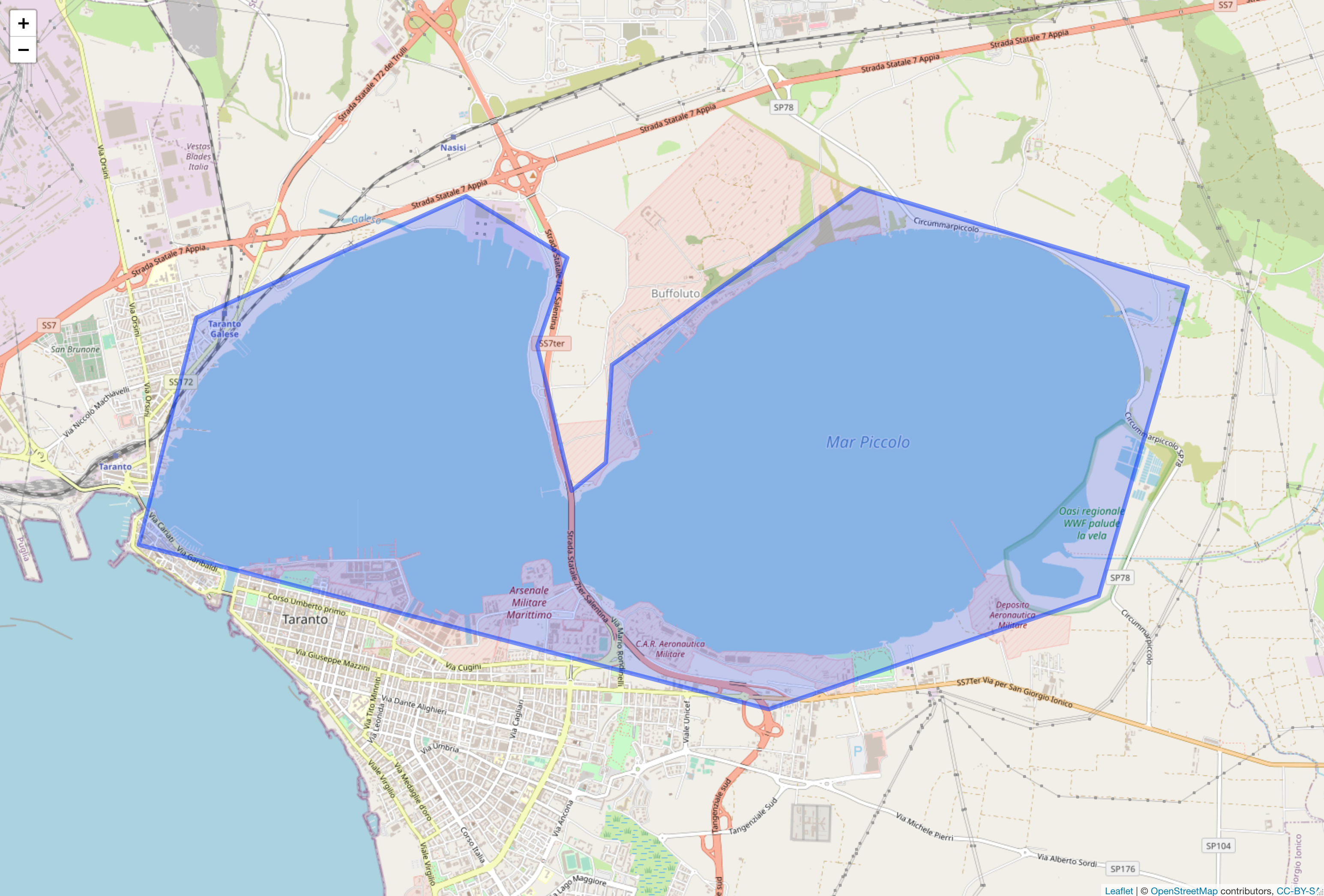
activities <- get_activity_info(
  activityid =
    "https://deims.org/activity/8786fc6d-5d70-495c-b901-42f480182845",
  show_map = TRUE
)
activities
#> $map
#>
#> $data
#> Simple feature collection with 1 feature and 19 fields
#> Geometry type: POLYGON
#> Dimension:     XY
#> Bounding box:  xmin: 17.22656 ymin: 40.46438 xmax: 17.33162 ymax: 40.50408
#> Geodetic CRS:  WGS 84
#> # A tibble: 1 × 20
#>   title    abstract keywords uri   type  created             changed
#> * <chr>    <chr>    <list>   <chr> <chr> <dttm>              <dttm>
#> 1 Study o… "The in… <df>     http… acti… 2021-01-22 10:16:33 2021-01-28 16:06:42
#> # ℹ 13 more variables: relatedSite <list>, dateRange.from <date>,
#> #   dateRange.to <lgl>, contacts.corresponding <list>,
#> #   contacts.metadataProvider <list>, boundaries <POLYGON [°]>,
#> #   availability.digitally <lgl>, availability.forEcopotential <lgl>,
#> #   availability.openData <lgl>, availability.notes <lgl>,
#> #   availability.source <lgl>, observationParameters <lgl>,
#> #   relatedResources <lgl>
#>